Introduction
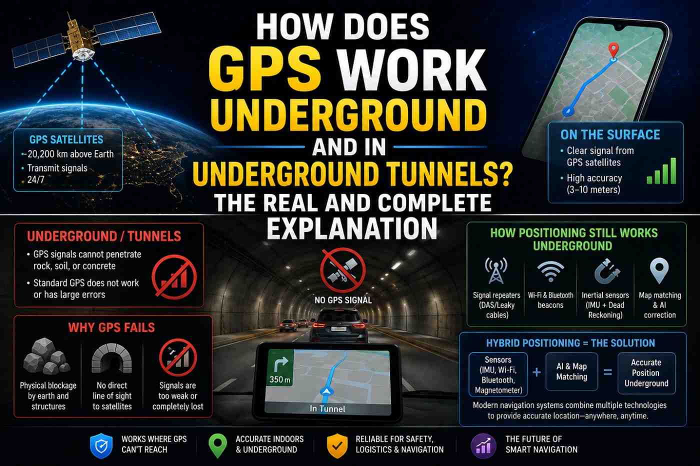
You are driving confidently with Google Maps guiding your route—then you enter a tunnel. Satellite bars disappear. But remarkably, the blue dot keeps moving. Turn instructions still come. Your phone seems to know exactly where you are, even below the ground. How does GPS work underground—and what technology is actually keeping your navigation alive when satellites cannot reach you?
The honest answer: GPS does not work underground. Satellite signals cannot penetrate solid rock, concrete, or earth. What keeps your phone navigating through tunnels, parking garages, and subway stations is a sophisticated combination of backup technologies that seamlessly fill the GPS gap. Understanding these systems not only satisfies curiosity—it helps you understand why navigation sometimes fails underground and how engineers are working to fix it.
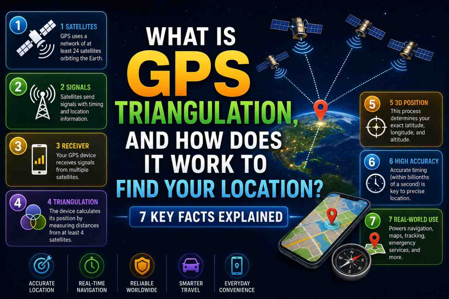
Also Read: What Is GPS Triangulation, and How Does It Work
Why GPS Does Not Work Underground
GPS signals are L-band radio waves—specifically around 1.2–1.6 GHz. While radio waves can travel through the atmosphere and even through some materials, they cannot penetrate:
- Rock and earth—any significant depth of solid ground blocks GPS signals completely
- Reinforced concrete—the metal in reinforced concrete creates a Faraday cage effect
- Tunnels—even a few meters of concrete overhead completely blocks satellite signals
- Underground parking structures—multiple floors of concrete eliminate all satellite reception
GPS requires line-of-sight to satellites. Without it, the receiver cannot lock on to any signal—regardless of signal strength or antenna quality.
This is a fundamental physical limitation, not a technology flaw. No amount of GPS chip improvement will allow satellite signals to penetrate substantial solid material.
How Does GPS Work Underground? The 5 Backup Technologies
Technology 1: Dead Reckoning (Inertial Navigation)
Dead reckoning is the primary fallback technology when GPS signal is lost. Your phone uses its onboard inertial sensors to continue tracking position:
Accelerometer: Measures acceleration in three dimensions. By integrating acceleration over time, the phone calculates distance traveled.
Gyroscope: Measures rotational velocity. Detects turns, curves, and direction changes with high precision.
Magnetometer (compass): Provides heading direction relative to Earth’s magnetic field.
Barometer: Detects altitude changes—useful for detecting which floor you are on in a multi-story parking structure or building.
Working together, these sensors allow your phone to track movement from the last known GPS position—estimating the current position continuously.
The limitation: Dead reckoning errors accumulate. Sensor drift, wheel slip, and measurement noise mean errors grow over time—typically 1–2% of distance traveled. After 500 meters in a tunnel, you might be 5–10 meters off true position. After 5 km underground, errors could reach 50–100 meters.
GPS reacquisition automatically corrects accumulated dead reckoning errors the moment satellite signals return.
Technology 2: Wi-Fi Positioning
Many modern tunnels, shopping centers, airports, subway stations, and underground venues deploy Wi-Fi access points throughout their infrastructure. Your phone can use these for positioning even without connecting to them.
Google’s Wi-Fi positioning database maps the locations of billions of Wi-Fi networks globally. When your phone scans Wi-Fi in an underground venue and finds known networks, it can estimate position to 10–40 meters accuracy.
This technology is why Google Maps often continues showing accurate positions in underground shopping malls and airport terminals—there is typically dense Wi-Fi coverage in these venues.
Technology 3: Bluetooth Beacon Positioning
Bluetooth Low Energy (BLE) beacons are small, inexpensive devices that broadcast a unique ID signal at regular intervals. Deployed strategically throughout underground venues, they create a positioning grid.
Your phone detects nearby beacon signals, and positioning algorithms calculate location based on signal strengths from multiple beacons.
BLE positioning can achieve 1–3 meter accuracy—comparable to outdoor GPS—making it excellent for indoor and underground navigation in equipped venues.
Major deployments include:
- Airport terminals (United, Delta, Heathrow)
- Shopping malls (Simon Property Group venues)
- Museum and stadium navigation systems
- Some subway systems
Technology 4: Cellular Network Positioning
When underground with cellular signal (common in road tunnels and urban subway systems that have antenna infrastructure), your phone can use cell tower positioning for coarse location.
Many major tunnels deploy Distributed Antenna Systems (DAS)—internal cellular repeater networks that provide 4G/5G coverage underground. These not only enable phone calls and data but also allow cell-based location estimates of 100–300 meter accuracy.
This is imprecise but sufficient to know which tunnel you are in and approximately where along its length.
Technology 5: Map Matching
Map matching is an algorithmic technique—not a positioning technology per se—that dramatically improves navigation accuracy in constrained environments like tunnels.
The principle: if you are in a tunnel, there are only a limited number of physically possible positions (along the tunnel’s centerline). Even if dead reckoning gives an imprecise position, map-matching algorithms snap your estimated position to the nearest valid road—dramatically improving displayed accuracy.
Navigation apps, including Google Maps, Apple Maps, and Waze, all use sophisticated map-matching algorithms. In a straight 500-meter tunnel, even a poor dead reckoning estimate gets corrected to the right position on the road.
How Google Maps Specifically Handles Tunnel Navigation
Google Maps combines all available technologies for tunnel navigation:
- Entry detection—when GPS signal drops at a known tunnel entrance, Maps marks the last GPS position
- Dead reckoning activation—Inertial sensors track movement from the last GPS fix
- Map matching—estimated positions are constrained to valid road geometries
- Speed estimation—Maps uses accelerometer data and pre-known speed limits to calibrate distance estimates
- Wi-Fi/Bluetooth fallback—if available in the tunnel, these supplement inertial data
- GPS reacquisition—on exiting the tunnel, GPS instantly corrects any accumulated dead reckoning error
In practice, for most road tunnels under 2–3 kilometers, this system is impressively accurate—often within 10–20 meters of true position at tunnel exit.
Subway and Metro Navigation: A Special Challenge
Subway navigation is one of the most challenging positioning problems in urban environments:
- Deep underground—no satellite, no surface Wi-Fi, varying cell coverage
- Complex route geometry—tunnels branch, merge, and run in multiple directions
- High-speed travel—positioning errors accumulate rapidly
- Multiple parallel tracks—determining which specific track you are on is difficult
Solutions being deployed:
- Dedicated subway beacon networks—cities including Tokyo, London, and New York are deploying BLE beacons in stations and some tunnel sections
- Carrier-phase GNSS—high-precision positioning near station entrances
- Vision-based positioning—experimental systems using cameras to recognize tunnel features
- Ultra-Wideband (UWB) positioning in newer infrastructure
Future Underground Navigation Technologies
The limitations of how GPS works underground are driving significant innovation:
- Low-frequency radio positioning—signals that can penetrate earth (used in mining)
- Magnetic field mapping—buildings create unique magnetic fingerprints that can be used for positioning
- 5G indoor positioning—5G’s millimeter-wave bands enable very high-precision indoor positioning
- Quantum inertial sensors—ultra-precise accelerometers that reduce dead reckoning drift to centimeters per kilometer
FAQs: How Does GPS Work Underground
Q1: Does GPS work in tunnels? No. GPS satellite signals cannot penetrate solid rock, concrete, or earth. Navigation in tunnels relies on dead reckoning, Wi-Fi positioning, Bluetooth beacons, and map matching.
Q2: How does Google Maps track me in tunnels? Google Maps uses your phone’s accelerometer and gyroscope for dead reckoning from the last known GPS position, combined with map matching to constrain estimated positions to valid road geometries.
Q3: Does GPS work in the London Underground or NYC subway? Not directly. Many subway systems are deploying Wi-Fi and Bluetooth beacon infrastructure to enable positioning in stations, but full tunnel positioning remains limited.
Q4: Why does navigation sometimes fail in parking garages? Multi-story parking garages block GPS completely and often have limited Wi-Fi coverage. Dead reckoning in tight, multi-level spirals is particularly challenging for inertial sensors.
Q5: How accurate is dead reckoning navigation? Dead reckoning accuracy is typically 1–2% of distance traveled. For a 1 km tunnel, expect 10–20 meters of error at exit, immediately corrected when GPS reacquires signal.
Q6: Will GPS ever work underground? Standard GPS satellite signals will never penetrate significant solid material due to fundamental physics. Alternative positioning systems (5G, BLE, magnetic field mapping) are the realistic path to improved underground navigation.
Conclusion
The truth about how GPS works underground is that it simply does not—and cannot. But the technologies that fill that gap are increasingly sophisticated and effective. Dead reckoning, Wi-Fi positioning, Bluetooth beacons, and smart map matching combine to deliver navigation experiences that feel seamless even beneath the surface. As 5G infrastructure expands and BLE beacon networks grow in major cities, underground navigation will continue improving dramatically. Explore how Google handles challenging navigation scenarios at the Google Maps Help Center and check out indoor mapping developments at Google Maps Indoor Maps.